
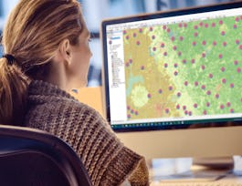
Geographic Information Systems (GIS) is becoming an essential business skill across a variety of different disciplines. In this course, you will explore how GIS skills are commonly applied and used in a variety of industries focusing specifically on: environmental studies, public health, emergency management, and business development. You will be empowered to conduct GIS-based analyses that are commonly used in these areas and benefit from how each industry uses GIS to tackle common analysis needs. Additionally, you will work through a series of hands-on exercises that will improve your knowledge of the advanced analysis capabilities of ArcGIS Pro.
GIS Applications Across Industries
GIS Applications Across Industries
This course is part of Geographic Information Systems (GIS) Specialization
Taught in English
Some content may not be translated

Instructor: Eric Howard
1,585 already enrolled
Included with 
Course
Gain insight into a topic and learn the fundamentals
4.6
(18 reviews)
Intermediate level
Recommended experience
16 hours (approximately)
Flexible schedule
Learn at your own pace
What you'll learn
Expand their knowledge for geospatial analysis and develop new skills on how to use the advanced geoprocessing tools inside of ArcGIS Pro.
Skills you'll gain
Details to know

Shareable certificate
Add to your LinkedIn profile
Assessments
4 quizzes
Course
Gain insight into a topic and learn the fundamentals
4.6
(18 reviews)
Intermediate level
Recommended experience
16 hours (approximately)
Flexible schedule
Learn at your own pace
See how employees at top companies are mastering in-demand skills

Build your subject-matter expertise
This course is part of the Geographic Information Systems (GIS) Specialization
When you enroll in this course, you'll also be enrolled in this Specialization.
- Learn new concepts from industry experts
- Gain a foundational understanding of a subject or tool
- Develop job-relevant skills with hands-on projects
- Earn a shareable career certificate


Earn a career certificate
Add this credential to your LinkedIn profile, resume, or CV
Share it on social media and in your performance review

There are 4 modules in this course
By the end of this module, you will be able describe what land use planning is and the planning process. You will be able to describe how GIS is commonly used in land use and conservation planning. You will be able to identify and find GIS datasets and common data sources and describe the processing steps used in land use change analysis. You will be able to conduct an analysis using land cover datasets to measure changes in land use over time. You'll be able to describe what a buildout analysis is and conduct a buildout analysis to evaluate the potential development growth in a given location. You will be able to explore common datasets, analytical tools and processes used in conservation planning. You'll be able to analyze a location and define its watershed boundaries as well as analyze GPS monitoring data to define wildfire ranges. You will be able to analyze and prioritize candidate locations for conservation efforts and be able to describe what citizen science is and the role it plays in community-based conservation strategies.
What's included
16 videos2 readings1 quiz2 discussion prompts
By the end of this module, you will be able to describe common GIS applications used in Public Health. You'll explore how GIS is used to track the spread of disease and analyze disease prevalence data and create maps showing the spread of disease. You will be able to explain what social determinates of health are and how they can be mapped using ArcGIS Pro. You will also be able to analyze and map the social determinates of health in a given community and describe how to measure community access to health-promoting resources.
What's included
7 videos1 reading1 quiz1 discussion prompt
By the end of this module, you will be able to describe how GIS is commonly used in Emergency Management. You will be able to define what hazard mitigation planning is and how GIS is commonly used in mitigation planning activities. You'll be able to analyze the wildfire risks of a community and describe how GIS is used to inform emergency preparedness activities. You will apply GIS methods to aid in the development of an evacuation plan and use GIS to aid first responders during an emergency event. Lastly, you'll be able to describe how GIS is used to track the progress of recovery from an emergency event.
What's included
5 videos1 reading1 quiz1 discussion prompt
By the end of this module, you will be able to describe how GIS is used in business applications and use GIS to identify potential customers and markets for a new business. You will be able to analyze demographic and employment data to locate a potential site for a new business. You will be able to describe how GIS can be used to inform Supply Chain Management and analyze potential warehouse locations based on the number of customers they can easily serve. You'll also be able to define location-base services and their common use cases, as well as discuss the role GIS plays in creating digital twins and in 3D visualization. You will also have the chance to create a 3D scene using ArcGIS Pro.
What's included
9 videos1 reading1 quiz3 discussion prompts
Instructor
Offered by
Recommended if you're interested in Business Essentials
University of California, Davis
University of California, Davis

University of California, Davis

Coursera Project Network
Why people choose Coursera for their career

Felipe M.
Learner since 2018
"To be able to take courses at my own pace and rhythm has been an amazing experience. I can learn whenever it fits my schedule and mood."

Jennifer J.
Learner since 2020
"I directly applied the concepts and skills I learned from my courses to an exciting new project at work."

Larry W.
Learner since 2021
"When I need courses on topics that my university doesn't offer, Coursera is one of the best places to go."

Chaitanya A.
"Learning isn't just about being better at your job: it's so much more than that. Coursera allows me to learn without limits."
New to Business Essentials? Start here.

Open new doors with Coursera Plus
Unlimited access to 7,000+ world-class courses, hands-on projects, and job-ready certificate programs - all included in your subscription
Advance your career with an online degree
Earn a degree from world-class universities - 100% online
Join over 3,400 global companies that choose Coursera for Business
Upskill your employees to excel in the digital economy
Frequently asked questions
Access to lectures and assignments depends on your type of enrollment. If you take a course in audit mode, you will be able to see most course materials for free. To access graded assignments and to earn a Certificate, you will need to purchase the Certificate experience, during or after your audit. If you don't see the audit option:
The course may not offer an audit option. You can try a Free Trial instead, or apply for Financial Aid.
The course may offer 'Full Course, No Certificate' instead. This option lets you see all course materials, submit required assessments, and get a final grade. This also means that you will not be able to purchase a Certificate experience.
When you enroll in the course, you get access to all of the courses in the Specialization, and you earn a certificate when you complete the work. Your electronic Certificate will be added to your Accomplishments page - from there, you can print your Certificate or add it to your LinkedIn profile. If you only want to read and view the course content, you can audit the course for free.
If you subscribed, you get a 7-day free trial during which you can cancel at no penalty. After that, we don’t give refunds, but you can cancel your subscription at any time. See our full refund policy.